118 RICHARD RD
Owner Information
MONTOWSKI, KENNETH M
118 RICHARD RD
LEOMINSTER, MA 01453


Property Details
118 RICHARD RD is classified as a condo (Townhse condo).
The primary structure on this property was built in 2011. There are 2,919ft2 of built area within this property. There is 1,375ft2 of residential/living space within this property. This property is listed as having 5 rooms.
118 RICHARD RD is valued at $284,300. The land is valued at $0 and the structures are valued at $284,300.
The most recent deed for 118 RICHARD RD is recorded at the local registrar in Book 8966, Page 043. 118 RICHARD RD was last sold on Wednesday, November 22, 2017 for $229,900.
Assessment data from fiscal year 2021.
Flood Data
According to the FEMA National Flood Hazard Layer, this property does not appear to be in a flood zone. It may also be in an area not yet reviewed. Nonetheless, confirm this information prior to taking any action.
To view the flood hazards around this property, create a FEMA "Firmette" Map of the area around 118 RICHARD RD.
Broadband Internet Providers
| Provider | Type | Bandwidth (mbps) | |
|---|---|---|---|
| Verizon New England Inc. | DSL | 10 | 1 |
| Verizon New England Inc. | Fiber | 940 | 880 |
| VSAT Systems, LLC. | Satellite | 2 | 1 |
| Comcast | Cable | 1000 | 35 |
| GCI Communication Corp. | Satellite | 0 | 0 |
| HughesNet | Satellite | 25 | 3 |
| Viasat Inc | Satellite | 100 | 3 |
Broadband service provider data from December 2020.
Adjacent Properties
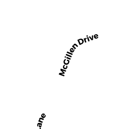
- 35 MCGILLEN DR
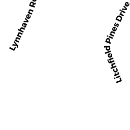
Apartments with More than Eight Units owned by SULLENDER ERIC W TR - 103-147A LITCHFIELD PINES DR
Other, Open Space owned by None - 107C LITCHFIELD PINES DR
condo owned by SHINNICK JOHN R ETUX - 112B LITCHFIELD PINES DR
condo owned by RODRIGUES RUPERT ETUX - 124D LITCHFIELD PINES DR
condo owned by WU YANLIN - 127D LITCHFIELD PINES DR
condo owned by KALLANDER LYNN ANN TR - 147D LITCHFIELD PINES DR
condo owned by KATZ DAVID L - 104D LITCHFIELD PINES DR
condo owned by THIBEAULT JAY - 107A LITCHFIELD PINES DR
condo owned by HUBERT KIMBERLY - 107B LITCHFIELD PINES DR
condo owned by SHEPARD MARLENE A - 107D LITCHFIELD PINES DR
condo owned by CALOCCI SANDRA M - 115A LITCHFIELD PINES DR
condo owned by HAYS KIMBERLY - 115B LITCHFIELD PINES DR
condo owned by BEDARD HECTOR E JR ETAL TRS - 115C LITCHFIELD PINES DR
condo owned by FAUCETT HENRY HAYWOOD JR ETAL - 115D LITCHFIELD PINES DR
condo owned by LOWNEY IRENE - 116A LITCHFIELD PINES DR
condo owned by LANCIANI GREGG D - 119C LITCHFIELD PINES DR
condo owned by SMITH ROBERT A - 119D LITCHFIELD PINES DR
condo owned by ORNE LAWRENCE E SR ETUX - 120A LITCHFIELD PINES DR
condo owned by MILLER JOAN L/E - 120B LITCHFIELD PINES DR
condo owned by KRIKORIAN JUDITH A ET AL - 120C LITCHFIELD PINES DR
condo owned by MARTINS JORGE L - 120D LITCHFIELD PINES DR
condo owned by KRIKORIAN KEVIN R ETUX - 123A LITCHFIELD PINES DR
condo owned by FIELDS JARED T - 123B LITCHFIELD PINES DR
condo owned by TELLES JOSE - 123C LITCHFIELD PINES DR
condo owned by ORTIZ LETICIA CASTILLO ETUX - 123D LITCHFIELD PINES DR
condo owned by TELLES JOSE - 124A LITCHFIELD PINES DR
condo owned by KATZ DAVID L - 124B LITCHFIELD PINES DR
condo owned by D'ONOFRIO MICHAEL V ETUX - 124C LITCHFIELD PINES DR
condo owned by KATZ DAVID L - 127A LITCHFIELD PINES DR
condo owned by SILVA ADIEL - 127B LITCHFIELD PINES DR
condo owned by JOTKA ELAINE C - 127C LITCHFIELD PINES DR
condo owned by CALDERON JORGE L - 131B LITCHFIELD PINES DR
condo owned by REMY RAYMOND R SR ETUX - 131C LITCHFIELD PINES DR
condo owned by LITCHFIELD PINES LLC - 131D LITCHFIELD PINES DR
condo owned by PLINTA AUDREY - 135A LITCHFIELD PINES DR
condo owned by BINACO ADELINA ET UX - 135B LITCHFIELD PINES DR
condo owned by CARROLL CHARLES S & PATRICIA L TRS - 135C LITCHFIELD PINES DR
condo owned by TELLES JOSE - 135D LITCHFIELD PINES DR
condo owned by DIBENEDETTO DAVID - 139A LITCHFIELD PINES DR
condo owned by RIVERA LUZ M - 139B LITCHFIELD PINES DR
condo owned by CICCONE DAVID M ETUX - 139C LITCHFIELD PINES DR
condo owned by RIVERA LUIS ET UX - 139D LITCHFIELD PINES DR
condo owned by TAVARES DINIS A - 143A LITCHFIELD PINES DR
condo owned by GUILLEMETTE DENISE M - 143B LITCHFIELD PINES DR
condo owned by DASILVA RUDNEI ETUX - 143C LITCHFIELD PINES DR
condo owned by ZUNIGA ARTURO - 143D LITCHFIELD PINES DR
condo owned by MARTINS JORGE L - 147A LITCHFIELD PINES DR
condo owned by DELACRUZ NICK ET UX - 147B LITCHFIELD PINES DR
condo owned by MITCHEM HERMAN R SR ETUX - 147C LITCHFIELD PINES DR
condo owned by COLDWELL LOUISE - 116B LITCHFIELD PINES DR
condo owned by DASILVA FUDNEI C ETUX - 116C LITCHFIELD PINES DR
condo owned by SOUSA MANUEL ANTONIO - 116D LITCHFIELD PINES DR
condo owned by MONIZ GREGORY M - 119A LITCHFIELD PINES DR
condo owned by PIANES MARCIA - 119B LITCHFIELD PINES DR
condo owned by CRUZ LEANDRO ET UX - 103A LITCHFIELD PINES DR
condo owned by WILDER CHUNIE J - 103B LITCHFIELD PINES DR
condo owned by K&M SA HOLDINGS LP - 103C LITCHFIELD PINES DR
condo owned by FITZGERALD BEVERLY A - 103D LITCHFIELD PINES DR
condo owned by BURKE PATRICK J ETAL - 104A LITCHFIELD PINES DR
condo owned by HUBERT DEBORAH A - 104B LITCHFIELD PINES DR
condo owned by ORNE LAWRENCE EDWARD ETUX - 104C LITCHFIELD PINES DR
condo owned by LYNCH MARIA T - 108A LITCHFIELD PINES DR
condo owned by SALAFIA JOAN M L/E - 108B LITCHFIELD PINES DR
condo owned by ORNE LAWRENCE E ETUX - 108C LITCHFIELD PINES DR
condo owned by LACKEY STANLEY A - 108D LITCHFIELD PINES DR
condo owned by NELSON LORI M - 111A LITCHFIELD PINES DR
condo owned by BIANCO ADELINA ETUX - 111B LITCHFIELD PINES DR
condo owned by KATZ DAVID - 111C LITCHFIELD PINES DR
condo owned by KATZ DAVID L - 111D LITCHFIELD PINES DR
condo owned by HUERTA JOSE ETUX - 112A LITCHFIELD PINES DR
condo owned by BATEMAN KATHLEEN V ZELNY - 112C LITCHFIELD PINES DR
condo owned by KIM PEDRO - 112D LITCHFIELD PINES DR
condo owned by CALDERON LUIS - 131A LITCHFIELD PINES DR
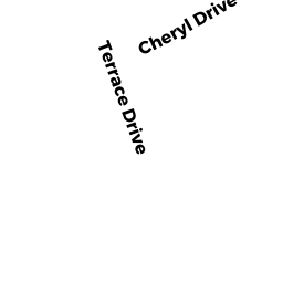
condo owned by BIANCO ADELINA ETUX - 1 CHERYL DR
Apt Subsidized C owned by LITCHFIELD-LEOMINSTER LP - 81 SAWTELLE RD
Single Family Residential owned by SLEEPER JOHN D ETAL - 69 SAWTELLE RD
Single Family Residential owned by DELILLO HELAINE L - 51 SAWTELLE RD
Single Family Residential owned by VEO STACY LYNN ETAL - 39 SAWTELLE RD
Single Family Residential owned by LUCENA NICOLAS - 1001 CENTRAL ST
Shopping Centers/Malls owned by JOHNNY APPLESEED REALTY LLC - 97 SAWTELLE RD
Single Family Residential owned by AUCLAIR ROGER ETUX - 105 SAWTELLE RD
Single Family Residential owned by APONTE APRIL ETUX - 113 SAWTELLE RD
Single Family Residential owned by CHRISTIAN SCOTT MICHAEL ETUX - 109 SAWTELLE RD
Single Family Residential owned by CHEN YI LIN ETUX